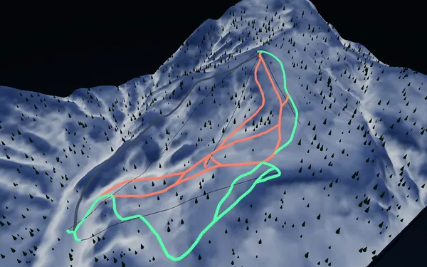
 出典:国土地理院 · © OpenStreetMap contributors / OpenSkiMap (ODbL)
Sapporo Kokusai · 3D map
Sapporo Kokusai ski map and terrain guide
A compact, high-set mountain inside Sapporo city limits, read as relief rather than a flat trail board.
- Elevation range
- 553–1,280 m
- Mapped vertical
- 727 m
- Run lines
- 20
- Lift lines
- 4
Reading the Sapporo Kokusai map
Sapporo Kokusai sits in the Jozankei direction of Sapporo, and its mapped terrain starts high: the SnowWind snapshot spans roughly 553 to 1,280 metres elevation, with about 727 metres of mapped vertical. That is a smaller footprint than the big multi-sector resorts, and the map reflects it — 20 run lines and four lift lines, classified in the source data as nine green, nine red and two black. The value of the 3D view here is seeing how a short lift network stacks a substantial vertical drop into one main face.
Named lines such as the Downhill course, Märchen, Swing, Forest, Woody, Family and Echo trails give anchors when moving between this model and the resort’s own course board. The gondola corridor and the Echo and Woody chairs organise most of the mountain. Treat the colour categories as map data, not as a report on grooming, closure or snow surface, and confirm the current course status with the resort before skiing.
Access and timing
The resort is reached from central Sapporo by road along the Jozankei route, with seasonal bus services commonly offered; timetables and reservation rules change each winter, so check the official access page for your travel date. The mapped terrain starts well above the city floor, and snow conditions here can differ noticeably from central Sapporo. The winter operating period is the relevant season for this map, and weather, wind and lift status — not a calendar date — decide whether a given day works. Use the model to understand vertical scale and course layout, then follow the on-mountain signage and official information.