 出典:国土地理院 · © OpenStreetMap contributors / OpenSkiMap (ODbL)
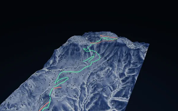
Sapporo Teine · 3D map
Sapporo Teine ski map: Highland and Olympia zones
A 1972 Olympic mountain above Sapporo, with the city and Ishikari Bay in view from the upper runs.
- Elevation range
- 173–1,023 m
- Mapped vertical
- 850 m
- Run lines
- 19
- Lift lines
- 12
How the Teine map is organised
Sapporo Teine rises directly above the city, and the SnowWind snapshot spans roughly 173 to 1,023 metres elevation — about 850 metres of mapped vertical. The current data contains 19 run lines and 12 lift lines, classified in the source as 11 green, four red and four black. The 3D relief is the quickest way to see how the lower Olympia side and the upper Highland side stack into one mountain rather than two separate hills.
The mapped names carry the mountain’s history and layout: the Sapporo Olympic women’s giant slalom course, the Seikadai (Olympic cauldron) lines including Ocean Stream, Ocean Dive and Ocean Cruise, plus City View Cruise and Panorama, North Face, Rainbow, Paradise and the Shirakaba runs. The Eight Gondola and Summit Express organise the upper mountain, with the Shirakaba, Paradise, Panorama and Seikadai chairs below. Colours are source classifications, not a statement about grooming, closures or snow surface on the day.
Access and planning
Teine is the closest large ski area to central Sapporo and is commonly reached by road or by seasonal bus and rail connections via Teine station; services and reservation rules change each winter, so confirm them with the official operator for your travel date. The proximity to the city makes short sessions practical, but it also means wind and visibility on the exposed upper mountain can differ sharply from conditions at the base. The winter operating period is the relevant season for this map. Use the model to understand the Highland–Olympia relationship and the vertical involved, then follow the resort’s live course status.