Muine-yama · Routes
↘ Muine-yama — Toyoha Motoyama Route
This route carries serious backcountry hazards. Its slope and ATES labels are planning estimates; they do not decide whether it is safe today or suitable for your group.
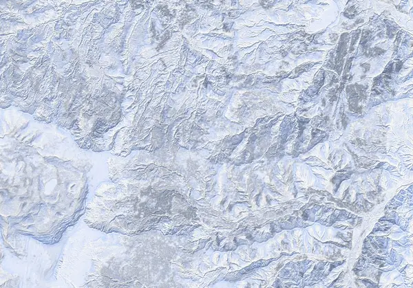 出典:国土地理院
Steepness · profile
← Distance 18.8 km →
Per-segment terrain (data table)
| % | m | Steepness | Aspect |
|---|---|---|---|
| 0% | 376 | 41° | NE |
| 3% | 432 | 36° | SE |
| 6% | 489 | 46° | SE |
| 10% | 545 | 38° | NW |
| 13% | 594 | 31° | S |
| 16% | 637 | 24° | NE |
| 19% | 682 | 39° | N |
| 23% | 728 | 40° | S |
| 26% | 778 | 40° | SE |
| 29% | 844 | 29° | E |
| 32% | 958 | 34° | S |
| 35% | 976 | 30° | NE |
| 39% | 1015 | 39° | SW |
| 42% | 1099 | 33° | SE |
| 45% | 1225 | 27° | N |
| 48% | 1344 | 39° | E |
| 52% | 1448 | 39° | NE |
| 55% | 1446 | 39° | NE |
| 58% | 1340 | 28° | E |
| 61% | 1224 | 35° | E |
| 65% | 1086 | 39° | SE |
| 68% | 1007 | 33° | S |
| 71% | 979 | 36° | SW |
| 74% | 894 | 32° | S |
| 77% | 801 | 40° | S |
| 81% | 739 | 37° | S |
| 84% | 696 | 29° | NW |
| 87% | 651 | 31° | SE |
| 90% | 603 | 38° | E |
| 94% | 549 | 46° | NE |
| 97% | 510 | 36° | S |
| 100% | 449 | 41° | SE |
Route guide
Muine-yama (1464 m) lies across Sapporo's southwestern skyline like a white whaleback, and the Toyoha Motoyama route is its front door: from the end of the Toyoha Mine road above Jozankei, a ~16 km round trip with 897 m of climbing, about 6 hours (4 up, 2 down), graded 7.5/10 by Hokkaido Wilds. One fact frames everything here: Muine-yama is reported to have the largest number of avalanche fatalities of any mountain in the Sapporo region (per the Hokkaido avalanche accident record) — a product of its popularity, its steep east-facing slopes and its tight, deep runout gullies. Read this as a description, not a recommendation.
[The climb] From the official parking at the road end, walk ~200 m to the trailhead and climb forested ridges to the Senjaku Plateau (1153 m) — a worthy objective in itself. Its north-northeast bowl is unambiguous avalanche terrain: the source's guidance is to avoid it on high-risk days. The 'uma-no-se' (horse's back) dip on the ridge is a known cornice spot.
[To the summit] Beyond Senjaku the broad summit plateau alternates skinning with poling and side-stepping to the 1464 m high point (trig 1460 m). It is north-facing, exposed ground — a clear-weather objective.
[The descent] Ski broadly along the ascent line. The baked 89° maximum is a local artifact of the Toyoha mine workings and rock walls, not the ski line (median ~21°) — but the slopes falling east are exactly the terrain the accident history describes. Stay off the east faces. Check the Japan Avalanche Network SW Hokkaido bulletin before departing and choose slopes conservatively.
Access & logistics
Start & parking: The official parking space at the end of the Toyoha Mine road (42.9795, 141.0401). Roadside parking is prohibited; the trailhead is a ~200 m walk. In spring you may be able to drive to the summer carpark.
Getting there: ~30 km from central Sapporo. Public transport reaches Jozankei only; from there a taxi covers the ~14 km (~30 min). Obey posted signs on the private mine-road section.
The day: ~16 km and ~6 hours; December–March. Expect fierce wind on the summit plateau in midwinter.
Onsen: Hoheikyo Onsen (¥1000) and Yunohana (¥850) in Jozankei. Confirm hours locally.
Info: Check the Japan Avalanche Network SW Hokkaido bulletin before departing.
Trip plan
Terrain (auto)
Slope-based estimate — not an official ATES rating.
Today's conditions
…
All values are estimates. Defer to official avalanche + weather bulletins.
Avalanche bulletin (read first)
Today's danger rating + avalanche rose (aspect/elevation) come from the official bulletin — check it before you go.
Pre-trip checklist
Hokkaido Wilds · Rob Thomson — HokkaidoWilds.org · CC BY-SA 4.0
Route data source: Rob Thomson — HokkaidoWilds.org · CC BY-SA 4.0 · ↓ Download GPX