Sandan-yama · Routes
↘ Sandan-yama — Higashi-no-tani
This route carries serious backcountry hazards. Its slope and ATES labels are planning estimates; they do not decide whether it is safe today or suitable for your group.
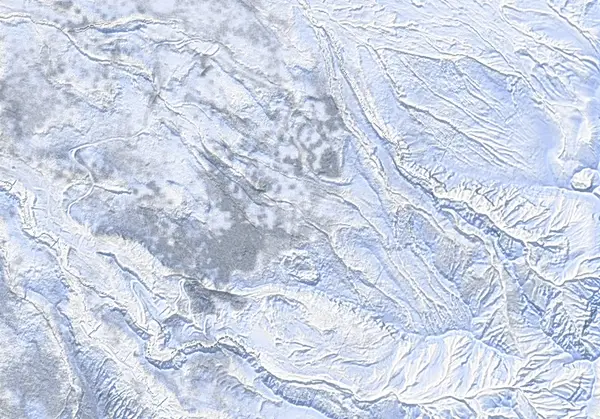 出典:国土地理院
Steepness · profile
← Distance 6.2 km →
Per-segment terrain (data table)
| % | m | Steepness | Aspect |
|---|---|---|---|
| 0% | 1011 | 25° | SW |
| 3% | 1031 | 18° | NW |
| 6% | 1058 | 15° | W |
| 9% | 1082 | 26° | NW |
| 13% | 1123 | 30° | W |
| 16% | 1175 | 21° | NW |
| 19% | 1204 | 27° | N |
| 22% | 1247 | 28° | NW |
| 25% | 1291 | 30° | NW |
| 28% | 1348 | 21° | W |
| 31% | 1380 | 32° | N |
| 34% | 1436 | 39° | NW |
| 38% | 1497 | 25° | NE |
| 41% | 1545 | 37° | W |
| 44% | 1596 | 35° | N |
| 47% | 1663 | 39° | NW |
| 50% | 1720 | 49° | NW |
| 53% | 1744 | 41° | NW |
| 56% | 1664 | 35° | N |
| 59% | 1604 | 37° | N |
| 63% | 1556 | 29° | W |
| 66% | 1511 | 36° | NW |
| 69% | 1448 | 44° | N |
| 72% | 1345 | 38° | NW |
| 75% | 1310 | 56° | NW |
| 78% | 1265 | 46° | N |
| 81% | 1229 | 40° | NW |
| 84% | 1198 | 38° | NE |
| 88% | 1186 | 25° | NW |
| 91% | 1151 | 27° | NW |
| 94% | 1089 | 20° | NW |
| 97% | 1062 | 16° | NW |
| 100% | 1035 | 20° | NW |
Route guide
Sandan-yama's Higashi-no-tani ('east valley') climbs the standard route from Fukiage Onsen's Hakuginso lodge (~1010 m) and drops a NE-facing variation into the gully system east of the ridge — about 6.2 km and ~730 m of vertical, graded 6.5/10 by Hokkaido Wilds. The crux is a steep (~150 m) entry and a half-pipe gully that is a textbook terrain trap, in ATES Complex (Level 3) avalanche terrain. Read this as a description of the ground, not a recommendation.
[The climb] From Hakuginso the skin track crosses the open cuts of the defunct Fukiage ski area and gains the main ridge (shared with the standard route). A waypoint at ~1372 m marks 'Higashi-no-tani (avalanche terrain)' where the variation peels off; the entry proper is assessed from above.
[The descent — a terrain trap] The line begins on entry slopes reaching about 53° and funnels into a walled half-pipe gully (the ~1219 m 'ski half-pipe gully' waypoint). A gully is terrain where even a small avalanche buries deep: there is no escape to the sides, and everything released above collects in the floor. This is not ground to enter without genuine confidence in stability. South of the valley sits the steaming Ansei crater basin (pooling volcanic gas — keep out).
[The avalanche reality] Avalanches here are not theoretical. In March 2026 a size-2 dry wind-slab in the Sandan-yama / Ansei crater area fully buried a ski tourer (crown ~100 m wide, ~500 m runout, SW aspect), ending in a beacon rescue and helicopter evacuation. Lee-side loading on this mountain happens at burying scale.
[Cautions] Tokachidake is at JMA Volcanic Alert Level 2 (~1.5 km around the 62-2 crater, since June 2026). The Sandan-yama summit is outside the zone, but the boundary runs close to the ridge east of it — and Higashi-no-tani faces that side. Check the live JMA bulletin, Kamifurano town notices and the JAN Central Hokkaido avalanche bulletin before every tour.
Access & logistics
Start & parking: The Hakuginso lodge carpark at Fukiage Onsen. Backcountry users park on the eastern side of the lot (lodge policy); overnight parking ¥500.
Getting there: In winter, access is only via Route 291 from the Kami-Furano side (Route 966 from Biei/Shirogane is closed). Bus from JR Kami-Furano Station: ~30 min, ~¥500, 3/day.
The day: ~6.2 km, ~730 m. Expect brutal cold — below −15°C at the lodge and −25°C windchill on top is routine in midwinter.
Onsen: Hakuginso day-use bath (~¥700); the free mixed open-air Fukiage rotenburo is a 10-minute walk down the road. Bunks ~¥3100/night, phone booking only; Jan–Feb weekends fill.
Info: Check the live JMA volcano bulletin, Kamifurano town notices and the JAN Central Hokkaido bulletin before departing.
Trip plan
Terrain (auto)
Slope-based estimate — not an official ATES rating.
Today's conditions
…
All values are estimates. Defer to official avalanche + weather bulletins.
Avalanche bulletin (read first)
Today's danger rating + avalanche rose (aspect/elevation) come from the official bulletin — check it before you go.
Pre-trip checklist
Hokkaido Wilds · Rob Thomson — HokkaidoWilds.org · CC BY-SA 4.0
Route data source: Rob Thomson — HokkaidoWilds.org · CC BY-SA 4.0 · ↓ Download GPX