Shakunage-dake · Routes
↘ Shakunage-dake — South Face
This route carries serious backcountry hazards. Its slope and ATES labels are planning estimates; they do not decide whether it is safe today or suitable for your group.
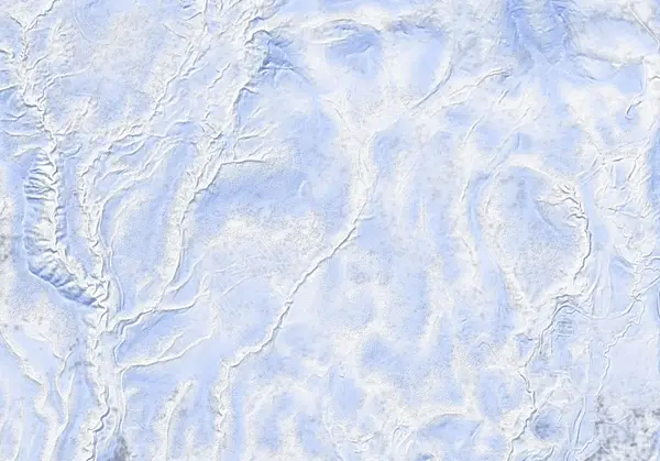 出典:国土地理院(標高タイル DEM10B を加工して作成)
Steepness · profile
← Distance 9.1 km →
Per-segment terrain (data table)
| % | m | Steepness | Aspect |
|---|---|---|---|
| 0% | 296 | 32° | S |
| 3% | 313 | 32° | W |
| 6% | 395 | 10° | SW |
| 10% | 404 | 14° | NW |
| 13% | 420 | 6° | W |
| 16% | 430 | 16° | W |
| 19% | 479 | 11° | SW |
| 23% | 511 | 13° | SW |
| 26% | 546 | 39° | S |
| 29% | 634 | 34° | S |
| 32% | 726 | 25° | W |
| 35% | 814 | 25° | W |
| 39% | 839 | 15° | SW |
| 42% | 865 | 17° | W |
| 45% | 863 | 26° | E |
| 48% | 916 | 38° | SW |
| 52% | 1041 | 40° | S |
| 55% | 988 | 38° | S |
| 58% | 882 | 25° | S |
| 61% | 862 | 18° | SE |
| 65% | 864 | 15° | NW |
| 68% | 846 | 26° | S |
| 71% | 826 | 43° | W |
| 74% | 683 | 41° | S |
| 77% | 562 | 18° | SW |
| 81% | 516 | 8° | S |
| 84% | 494 | 16° | S |
| 87% | 445 | 12° | SW |
| 90% | 424 | 12° | W |
| 94% | 403 | 19° | NW |
| 97% | 374 | 46° | N |
| 100% | 311 | 46° | W |
Route guide
The South Face climbs a south-southwest ridge from the Niimi Pass side (the end of snow clearing on Route 268, ~294 m) to reach the south face of the 1074 m summit. Hokkaido Wilds gives ~9.2 km and ~729 m of gain. The bake reads the aspect as southwest (SW) with a line median of ~14°, but the maximum pitch reaches 42–43° and the route is classed ATES 'complex.' Read this as a description, not a recommendation.
[Terrain] A quiet ridge through old-growth forest leads over a plateau, then up a steep wall, and along a ridge with Niseko Range views to the summit's south face. The descent follows the fall line on the south face or a southwest spur (the 'More expedient descent' waypoint). The median angle is gentle, but — as the source states plainly — the south face directly below the summit is steep and is a slope to avoid when avalanche ratings are high.
[Avalanches] The south-to-southwest aspect takes both sun (especially late season into spring) and wind-loading. The steep wall below the summit and the spur are complex terrain where escape lines are hard to read. Check the Niseko avalanche bulletin and the JAN SW Hokkaido bulletin before departing, and make your own stability assessment.
Access & logistics
Start & parking: Begin near the winter end-of-plowing on Route 268 (the Niimi Pass road), around 294 m (Hokkaido Wilds access point: 42.859°N, 140.551°E). Roadside space is limited and shifts with plowing.
Getting there: Car only, from the Niimi Onsen direction. Expect snow and ice — 4WD with winter tyres. Public transport is effectively none.
The day: A long ~9.2 km, ~729 m tour — an old-growth ridge over a plateau, a steep wall and a ridge to the south face.
Info: Check the Niseko avalanche bulletin and the JAN SW Hokkaido bulletin before departing.
Today / tomorrow briefing
Loading…
Set reminders inside Google Calendar
Hokkaido Wilds · Rob Thomson — HokkaidoWilds.org · CC BY-SA 4.0
A planning aid, not a verdict. Always check the day’s official avalanche bulletin and decide in the field.
Route data source: Rob Thomson — HokkaidoWilds.org · CC BY-SA 4.0 · ↓ Download GPX