Mt Asahidake · Routes
↘ Asahidake — Nakadake Onsen Loop
This route carries serious backcountry hazards. Its slope and ATES labels are planning estimates; they do not decide whether it is safe today or suitable for your group.
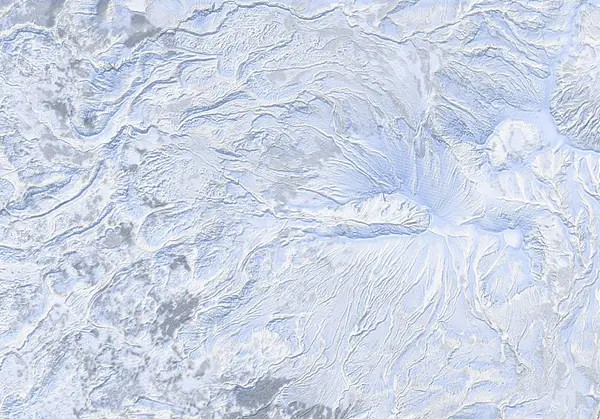 出典:国土地理院
Steepness · profile
← Distance 14.6 km →
Per-segment terrain (data table)
| % | m | Steepness | Aspect |
|---|---|---|---|
| 0% | 1600 | 22° | NE |
| 3% | 1628 | 29° | S |
| 6% | 1736 | 39° | SW |
| 10% | 1883 | 39° | NW |
| 13% | 2048 | 38° | W |
| 16% | 2211 | 47° | S |
| 19% | 2274 | 27° | E |
| 23% | 2147 | 25° | E |
| 26% | 2077 | 28° | S |
| 29% | 2101 | 37° | S |
| 32% | 2146 | 33° | SE |
| 35% | 2183 | 36° | NE |
| 39% | 2091 | 32° | NE |
| 42% | 2006 | 47° | W |
| 45% | 1887 | 62° | NW |
| 48% | 1826 | 36° | W |
| 52% | 1794 | 32° | N |
| 55% | 1774 | 32° | NW |
| 58% | 1756 | 35° | NE |
| 61% | 1760 | 38° | NW |
| 65% | 1763 | 30° | NW |
| 68% | 1742 | 31° | SW |
| 71% | 1685 | 25° | S |
| 74% | 1637 | 24° | W |
| 77% | 1603 | 28° | W |
| 81% | 1488 | 34° | SW |
| 84% | 1411 | 26° | SW |
| 87% | 1370 | 37° | SW |
| 90% | 1297 | 18° | S |
| 94% | 1253 | 26° | W |
| 97% | 1202 | 31° | W |
| 100% | 1153 | 30° | NW |
Route guide
The Asahidake — Nakadake Onsen Loop crosses over Asahidake (旭岳, 2291 m), Hokkaido's highest peak, then traverses the Ohachidaira (お鉢平) crater rim toward the Nakadake junction and drops to a wild hot spring on the far side — roughly 1,190 m of vertical over about 15 km. Aspect is mixed (the summit cone faces south to west; the plateau beyond is varied, broadly east), and it is classified Complex (ATES Level 3) avalanche terrain. Read this as a description of the ground, not a recommendation. The tour starts from the Asahidake Ropeway Ski Area.
From the top of the ropeway (the Sugatami rime-ice zone) you head for the summit cone of Asahidake. The lower mountain passes the steaming, sulphurous fumarole ground (Jigokudani) off to the side, climbing from gentle snowfields onto steadily steeper ground. There is almost no forest shelter here — you are in full alpine terrain from early on.
On the summit cone the angle stands up and the surface is routinely wind-hammered: crust, ice and sastrugi are the norm. The 51° maximum-slope figure reflects short steep sections on the upper cone and the steep crater-side walls rather than the angle of the skinning line as a whole — treat it that way. Where skins stop holding, ski crampons or boot crampons may be needed. Topping out brings you to the Asahi-dake Summit (2,291 m).
The crux of this route is what lies beyond. From the summit you make a long traverse across the broad, flat, near-featureless alpine Ohachidaira plateau and crater rim toward Mamiya-dake and the Nakadake junction. There is almost no terrain to navigate by, and if visibility drops you can lose orientation completely — this is the single most serious hazard of the tour. GPS is essential; back it up with a compass and confirm your line one leg at a time. Watch for volcanic gas near the vents inside the rim. Extreme wind, a persistent weak layer and severe cold are constant companions.
From the Nakadake junction you drop a slope to the Nakadake Onsen Hotspring — not a managed facility but a natural wild hot spring welling up beside a stream amid snow-buried volcanic terrain. Even past the spring there is a return leg back toward the ropeway / ski area side. Remember that this is a full-day, committing tour, far harder to retreat from than a simple out-and-back: once you commit to crossing the rim, bailing means long distances and re-ascents.
The most important hazard on the descents and traverses is dropping the wrong aspect. Asahidake and the cones around Ohachidaira are isolated volcanic features, and high up, near-identical, featureless slopes fall away on every aspect. In flat light (overcast or gas that erases all shadow and texture) it is easy to ski off onto an aspect other than the one you planned and be funneled into a different drainage — a mistake made on these isolated cones every season. Descend the aspect you planned while continuously checking elevation and bearing with GPS and compass. This is avalanche terrain; the stability assessment and every go/no-go decision are your own. Check the current JAN (Japan Avalanche Network) Central Hokkaido / Daisetsuzan bulletin.
Access & logistics
[Trailhead & parking] The tour starts at the Asahidake Ropeway Ski Area. There is parking near the base station; most parties ride the ropeway up to Sugatami (the upper station) and begin from there. Hours, ropeway operation and the last-ride time vary with season and weather — always check the day's operating status.
[Getting there] Approach is normally by car from the Asahikawa direction to Asahidake Onsen. Expect snow and ice on winter roads; studless winter tyres (and 4WD if needed) are appropriate. Public transport (bus) is limited and infrequent, so confirm the timetable in advance.
[Where the traverse/descent starts] After climbing from Sugatami over the Asahi-dake summit (2,291 m), you make a long traverse across the Ohachidaira rim toward the Nakadake junction. This is not a simple out-and-back — once you commit to crossing the rim it becomes a committing, full-day tour that is hard to retreat from. From the Nakadake junction you drop in to the wild Nakadake Onsen. Carry GPS/compass for poor visibility.
[After] The Asahidake Onsen area has lodges and onsen offering day-use bathing. Note that Nakadake Onsen itself is an unmanaged natural wild spring with no facilities. Hours and winter opening vary by venue, so confirm locally.
Trip plan
Terrain (auto)
Slope-based estimate — not an official ATES rating.
Today's conditions
…
All values are estimates. Defer to official avalanche + weather bulletins.
Avalanche bulletin (read first)
Today's danger rating + avalanche rose (aspect/elevation) come from the official bulletin — check it before you go.
Pre-trip checklist
Hokkaido Wilds · Rob Thomson — HokkaidoWilds.org · CC BY-SA 4.0
Route data source: Rob Thomson — HokkaidoWilds.org · CC BY-SA 4.0